Sabang, Indonesia
From Wikipedia, the free encyclopedia
| Sabang | ||
|---|---|---|
| City | ||
|
||
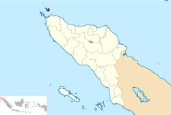
 Location of Sabang in Aceh |
||
|
|
||
|
|
||
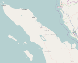
| Coordinates: 5°53′39″N 95°19′9″ECoordinates: 5°53′39″N 95°19′9″E | ||
| Country | Indonesia | |
| Province | Aceh | |
| Government | ||
| • Mayor | Zulkffi H Adam | |
| Area[citation needed] | ||
| • Total | 153 km2 (59 sq mi) | |
| Population (2010)[citation needed] | ||
| • Total | 37,531[1] | |
| Time zone | WIB (UTC+7) | |
| Area code(s) | +62 652 | |
| Website | sabangkota.go.id | |
The Japanese occupied the island and installed numerous bunkers, fortifications and gun emplacements. Their remnants can still be seen, though most have been re-purposed or removed.
Islands
- Klah Island (0.186 km²)
- Rondo Island (0.650 km²)
- Rubiah Island (0.357 km²)
- Seulako Island (0.055 km²)
- Weh Island (121 km²)
Sabang is served by the Maimun Saleh Airport. The airport is located southeast of the central city on Weh Island.
International sail tourism event
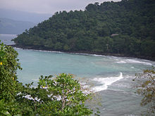
Sabang Municipality hosted an international sail tourism event in September 2011. The sail race was participated in by around 50 ships with 15 crew members each. Besides sailing they visited interesting places packed in a 'tsunami' tourism, visit Gapang and Iboih Beach with enchanting underwater scenery.[3]References
- "Sabang profile". sabangkota.go.id. Retrieved 13 December 2013.
- Seta,William J. Atlas Lengkap Indonesia dan Dunia (untuk SD, SMP, SMU, dan Umum). Pustaka Widyatama. p. 7. ISBN 979-610-232-3.
- RH, Priyambodo (28 May 2011). "Sabang to host sail tourism event in September". antaranews.com. Retrieved 13 December 2013.
External links
| [hide]
Regencies and cities of Aceh
|
||
|---|---|---|
|
Capital: Banda Aceh
|
||
| Regencies | ||
| Cities |
| |


0 komentar:
Posting Komentar